


The Civil War in Confederate Arizona Territory
Union soldiers of the California Column marched from California to El Paso to oust the Confederates

In April 1861, as the Civil War began, Union troops that were stationed out west protecting the Frontier were recalled east to fight the major battles. The Confederates devised a plan to conquer the southwest to take advantage of this.


After a Confederate force of 120 men took Tucson, Arizona March 1,1862, they hoped sympathizers in southern California would soon join them so they could forge a Confederate path to the Pacific Ocean. This did not happen.
The Union’s California Column
The California Column was a group of 2350 Union volunteers who marched over 900 miles from California, through Arizona and New Mexico Territories to El Paso, Texas between April and August of 1862. It was their job to push the Confederates out of Arizona Territory.

They moved east to Fort Yuma, California (located across the Colorado River from Yuma, Arizona) before they entered Confederate Arizona Territory. This was on the Butterfield Overland Mail route from 1859 until it ceased operations when the war began in 1861.
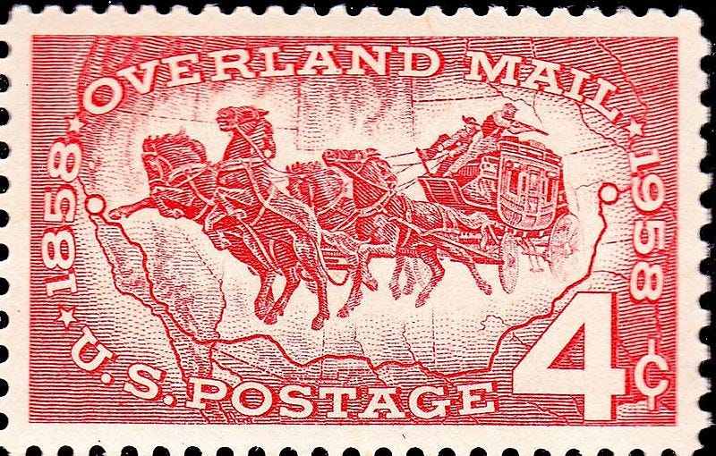
Butterfield Overland Mail Route
From 1857 to 1861, the U.S. Postal Service sent mail west from St. Louis to San Francisco using the Butterfield Overland Mail Route which was a 3,300-mile stagecoach route.
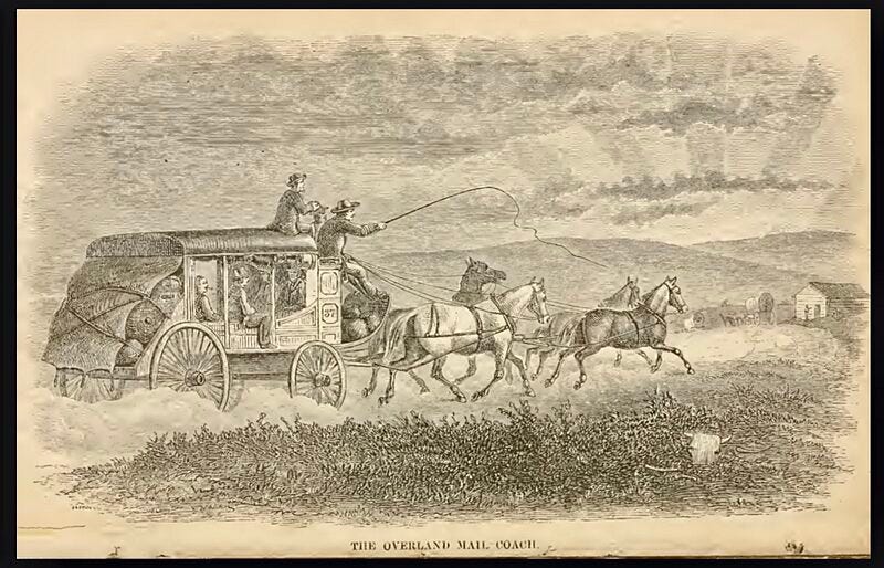
At the closing of Butterfield’s operations on the Southern Overland Trail in March 1861, because of the start of the Civil War, many of the stages were confiscated and used by the Confederate Army as military vehicles.
At least four battles of the American Civil War occurred at or near Butterfield mail posts:
Battle of Stanwix Station, Arizona Territory
Battle of Picacho Pass, Arizona Territory
Second Battle of Mesilla, Arizona Territory (currently in the state of New Mexico)
Battle of Pea Ridge, Arkansas
Four clashes between the Apache and Confederate or Union forces in the Apache Wars occurred on the route (all located in Arizona Territory as well as present day Arizona):
First Battle of Dragoon Springs
Second Battle of Dragoon Springs
Battle of Apache Pass
Skirmish in Doubtful Canyon.
These skirmishes with the Native Americans are considered part of the Civil War. Apache Wars will be a topic of a future post.
Confederates attempted to keep the stations from Tucson to Mesilla open while they destroyed the stations from Tucson to Yuma which were used to supply the Union army as it advanced through Arizona.
Battle of Stanwix Station
The westernmost skirmish of the Civil War, which occurred on March 29, 1862, at a former stagecoach station, Stanwix Station, AZ (80 miles east of the California border). A vanguard of 272 troops from the California Column discovered a small detachment of Confederate Arizona Volunteers (10 troops) burning hay which was left at the abandoned station for the California Column's animals.
A brief exchange of gun fire with the much larger Union force caused the Confederates to retreat to Tucson. The burning of hay here and at five other former stagecoach stations along the route east of Fort Yuma, delayed the California Column's advance to Tucson and Mesilla, the territorial capital of Confederate Arizona. In addition, it allowed the Confederates to warn Tucson of the advancing California Column. This led Confederates to place pickets at strategic locations, leading to the Battle of Picacho Pass.
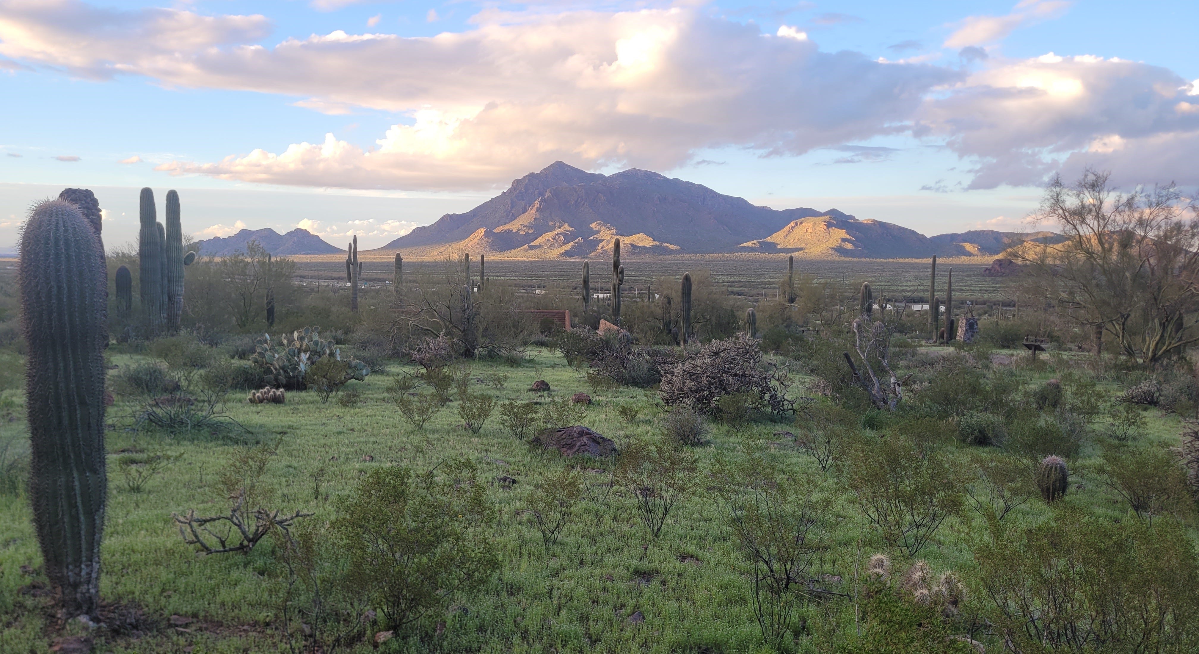
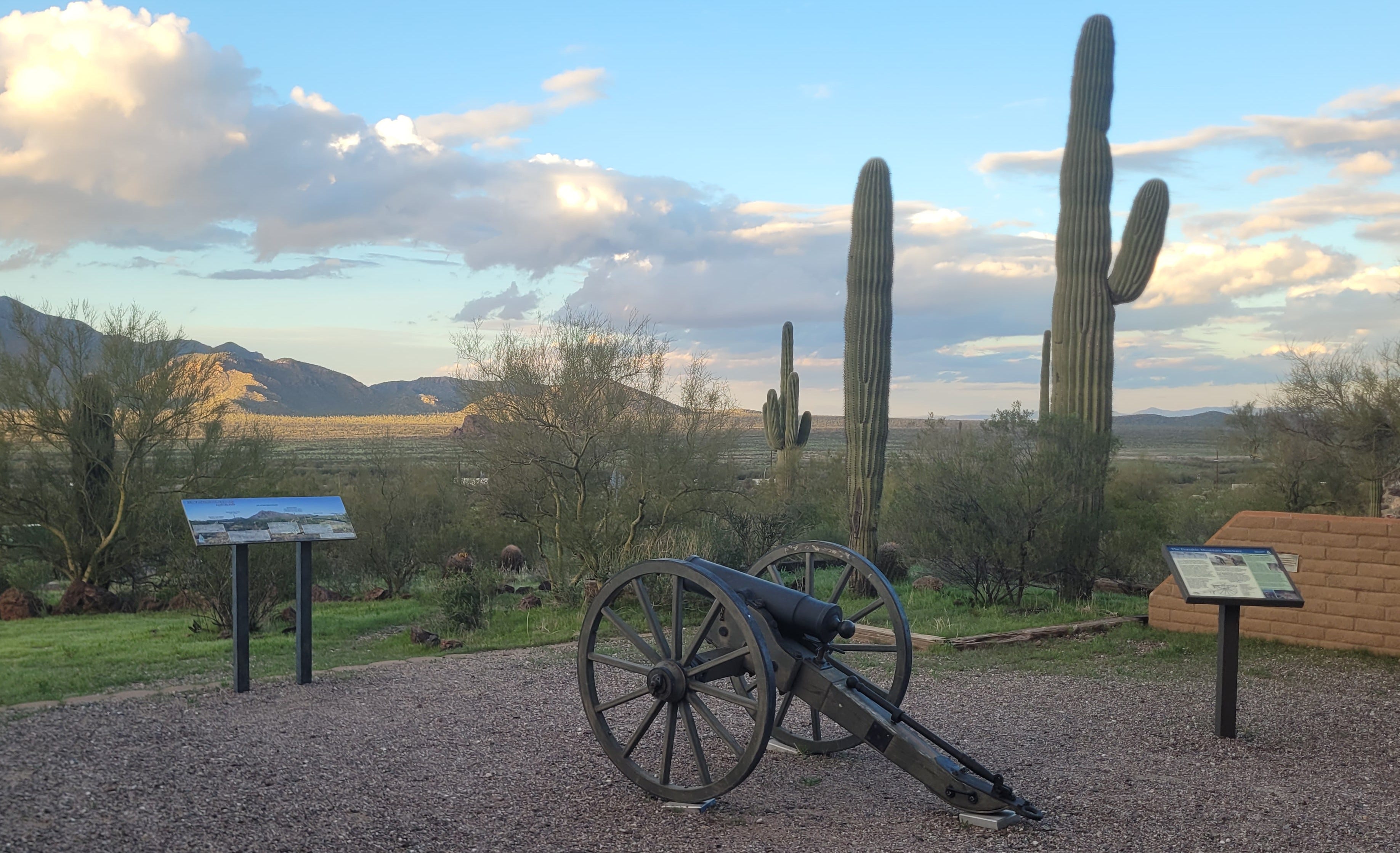
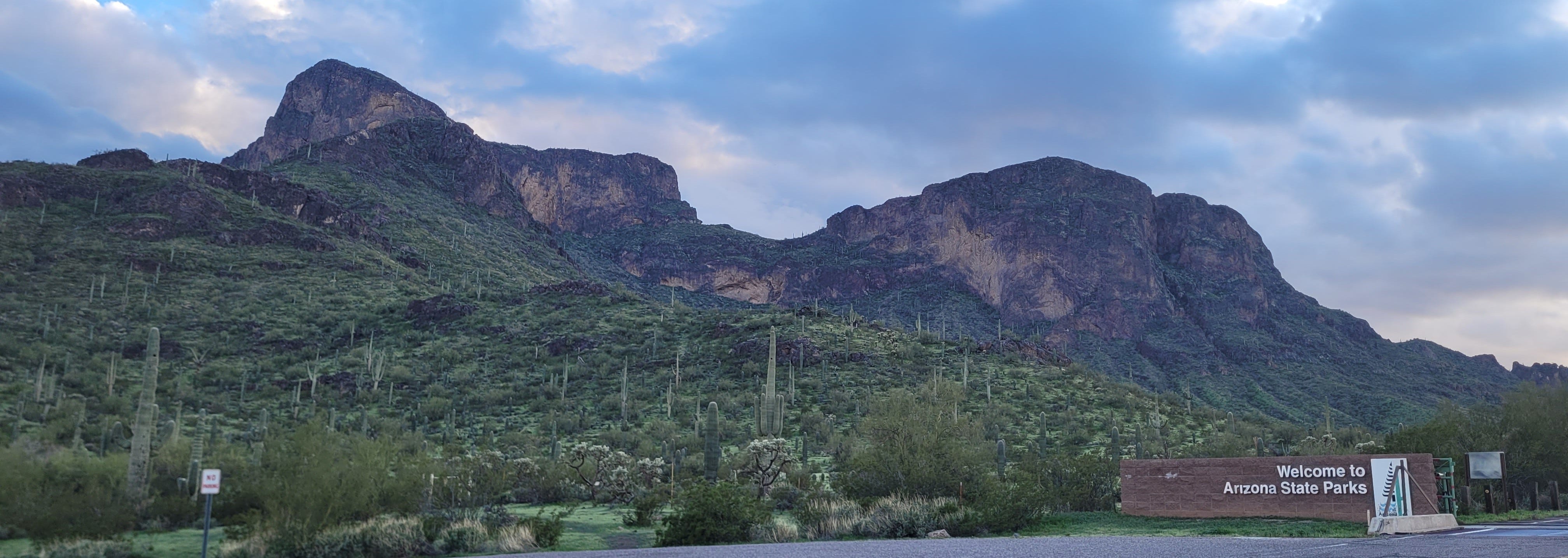
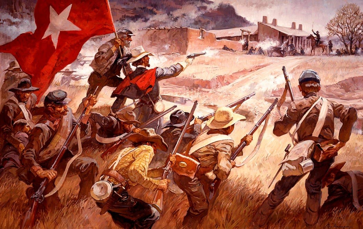
Battle of Picacho Peak
The Battle of Picacho Pass, also known as the Battle of Picacho Peak, was an engagement of the Civil War that occurred on April 15, 1862, near Picacho Peak, which is located 50 miles northwest of Tucson, Arizona. The skirmish involved just two dozen men and resulted in three dead, three wounded, and three captured. This battle is usually considered the farthest west Civil War engagement since casualties were involved. The battle was a Confederate victory causing the Union cavalry to retreat.
In my last post, I discussed the fact that the Confederates held the town of Tucson during this time. When the victorious Confederate soldiers returned to Tucson after the battle, they shared the information that the California Column was on its way. When the California Column entered Tucson days later, they found that the Confederates holding the town had fled. The Union was able to regain control of Tucson without a shot being fired.
Up until the Corona Virus shutdown, volunteers would have an annual reenactment of the battle at Picacho Peak State Park during the month of March. During my research, it appears that they haven’t held the event since 2019.
Second Battle of Mesilla
July 1, 1862, saw the last engagement between the Union and Confederates in Confederate Arizona Territory (present-day New Mexico). It took place at a stage stop outside Mesilla, Confederate Arizona’s capital, between Confederate and local pro-Union New Mexico guerrillas.
The California Column arrived on the west bank of the Rio Grande on July 4, 1862, which prompted the rebel army to withdraw the Arizona Territorial government to Franklin (present-day El Paso, Texas) and then onto San Antonio, Texas where it remained for the duration of the Civil War.
How to Visit
Picacho Peak State Park
Picacho Peak State Park is located right off of Interstate 10 approximately 50 miles northwest of Tucson, Arizona. In addition to a Civil War interpretive area about the battle, the park has camping and hiking.
The word “picacho” means “peak” in Spanish. Referring to this landmark as Picacho Peak is redundant (“Peak Peak”).
Butterfield Overland National Historic Trail
While the Butterfield Overland lasted only until 1861, the operation and the trail it forged played a vital role in shaping and connecting the young United States in a time of territorial expansion and sectional tension. The Butterfield Overland National Historic Trail (NHT) was added to the National Trails System administered by the National Park Service (NPS) on January 5, 2023. The NHT is 3292 miles long, crosses seven states, and was designated to commemorate the impact the Butterfield Overland Mail service had on the shaping of the nation. Since it’s so new, the NPS is still working on adding sites that can be visited.
Fort Yuma
Fort Yuma is now part of the Fort Yuma Indian Reservation. On the Arizona side of the Colorado River there is the Yuma Territorial Prison Museum.
Next Time
My next post will cover the Confederate’s New Mexico Campaign that includes the Battle of Glorietta Pass which took place near Santa Fe, New Mexico. That battle pretty much ended the Confederacy’s hopes of moving west.
This is interesting. Just last night I was post-processing photos I took at the mission near Glorieta Pass. They’ll be in my Substack in October, and I’ll link to your post when I write it.
This is just fascinating history Jan! Keep them coming!