Welcome to The Four Corners of the Southwest. My love for travel and the outdoors has inspired me to learn, research, and share interesting information about the American Southwest.
I’ve passed the turn-off the Natural Bridges National Monument on state route 191 in southeast Utah at least a half dozen times heading between Moab and Tucson and never had the time to stop until I made a point to do so on my Monument Valley trip. This park is in the center of the path of the Annular Eclipse happening on October 14 and would be a good viewing spot.
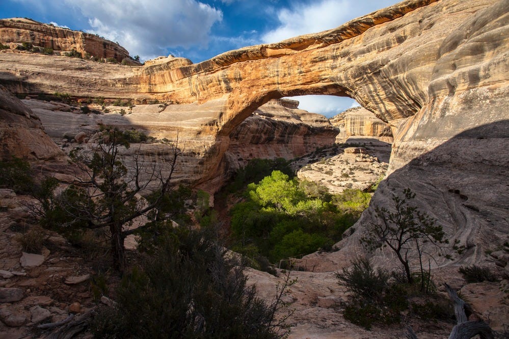
In 1883, settlers became aware of the three stone bridges that are among the largest natural bridges in the world. President Theodore Roosevelt signed the proclamation in 1908 that created Natural Bridges National Monuement as the first National Park site in the state of Utah.
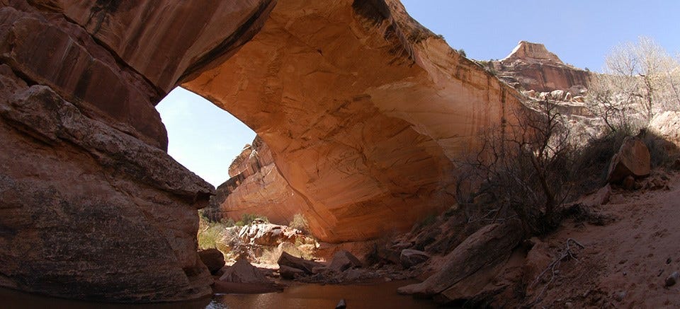
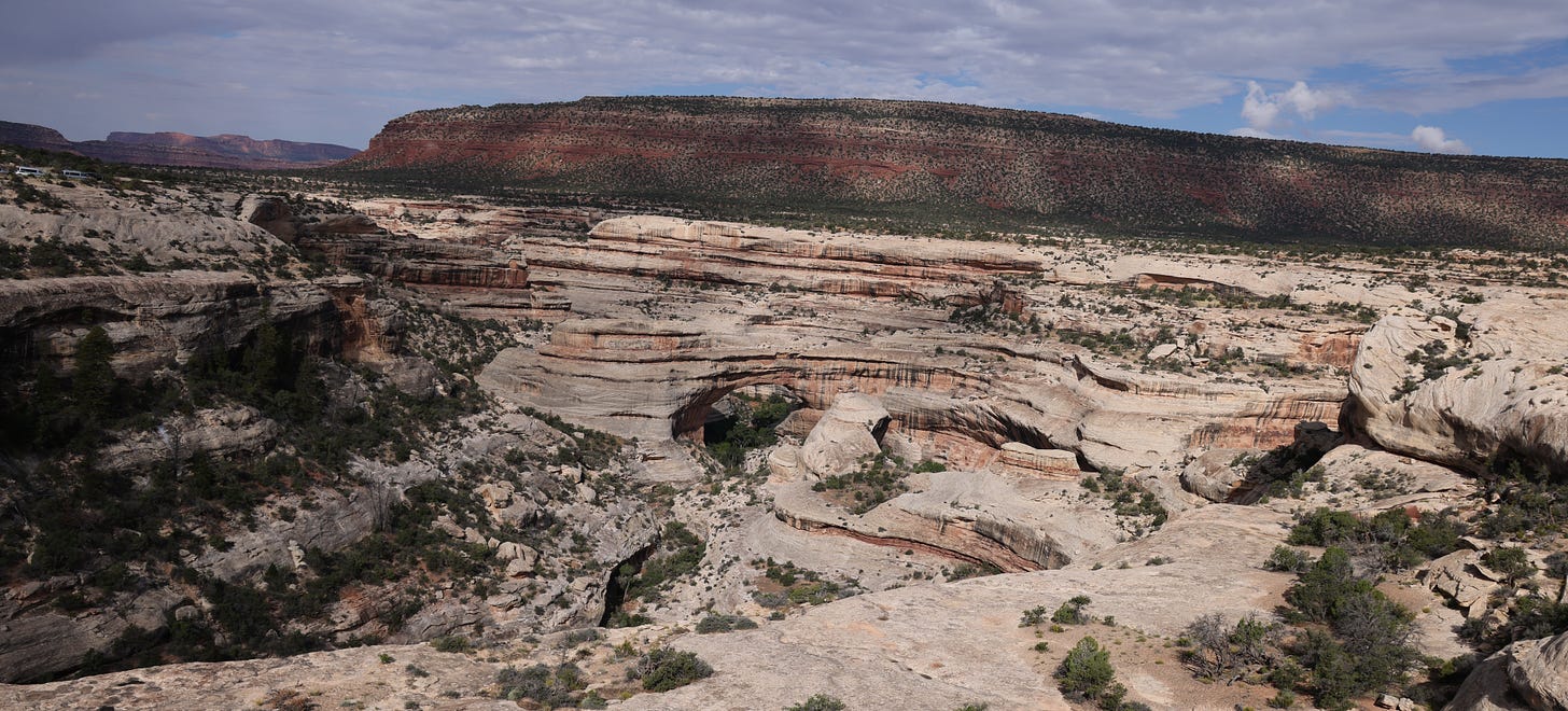
The bridges have undergone several name changes throughout the years, but their current names have been taken from the Hopi language: Sipapu, Kachina and Owachomo Bridges. While each of the three bridges can be viewed from short, paved walks at overlooks along the nine-mile Bridge View Drive, better views can be experienced by hiking into the canyon. There are various out-and-back or loop hikes you can choose to take.
Here's the link to the National Park Service (NPS) website for the Monument.
Ancestral Pueblo Ruins
In addition to the bridges, there are many ancient ruins in the area. One of the biggest and best preserved is the Horse Collar Ruin (named for the shape of the doorways of the two circular rooms pictured above). A short, paved 0.3-mile walk to an overlook allows you to view ancient cliff dwellings of Ancestral Puebloan people from a distance. Bring your binoculars as the ruins are a good distance away from the viewpoint.
What’s the Difference Between a “Natural Bridge” and an “Arch”?
In this corner of Utah there are a relative abundance of “bridges” and “arches”. They are different. A natural bridge is formed when flowing water (a stream or creek) cuts through the rock creating an opening. In contrast, an arch is formed by other forces of erosion typically wind and the freezing and thawing of water in cracks that break away rock creating an arch.
Bear’s Ears National Monument Surrounds Natural Bridges
Natural Bridges NM is surrounded by the larger Bears Ears National Monument that was established in December of 2016 by President Obama. It’s probably best known for being reduced in size by President Trump and then restored to its original size by the presidential proclamation of President Biden. In addition to surrounding Natural Bridges, the northern part of the Bear’s Ears borders Canyonlands National Park and parts also border Glen Canyon National Recreation Area.
The area is named for a pair of buttes that have the same name in each of the native languages of the region and English: Bears Ears.
The area within the monument is largely undeveloped and contains historic, cultural and natural resources. There are over 100,000 archaeological sites protected within the monument.

A unique fact is that it’s co-managed by the Bureau of Land Management (BLM), United States Forest Service (USFS) and the Five Tribes of the Bears Ears Commission (Navajo, Hopi, Ute Mountain Ute, Ute Indian Tribe of the Uintah and Ouray Reservation, and Pueblo of Zuni). All five of the tribes have ancestral ties to the region. The cooperation between these entities represents a shift towards more authentic community consent-based land management and can serve as a model for other areas to be managed in a similar manner in the future.
In this monument, which is larger than the state of Delaware, there are many remote places to visit such as Valley of the Gods and Moki Dugway.
Moki Dugway
I was driving north to Natural Bridges NM from Mexican Hat. Google Maps sent me north on UT Route 261. I didn’t know anything about the road and was surprised to come across this sign. What I didn’t realize is that this piece of road is called Moki Dugway and is famous for its steep, unpaved, but sharp switchbacks, which ascend 1,200 feet to the top of Cedar Mesa. Apparently, the word "Dugway" is term that refers to a roadway carved into a hillside or mountain.
The Moki Dugway was constructed in 1958 to haul ore from Cedar Mesa to Mexican Hat. While UT Route 261 is paved, the three-mile section of switchbacks is not. It's not recommended for vehicles over 28-feet long or over 10,000 pounds to traverse this road. There is another route to get to the monument avoiding the Dugway which is Highway 95 south Blanding, UT. I was happy to have come across this stretch of road and would like to revisit the area and spend more time (I was on a tight schedule).
More information about the Dugway and additional pictures can be found here.
Natural Bridges was Named the First Dark Sky Park
I learned of the organization Dark Sky International was when my son was presented with an award from them at a regional elementary school science fair. They are big into light pollution education and certify starry sky parks around the world.
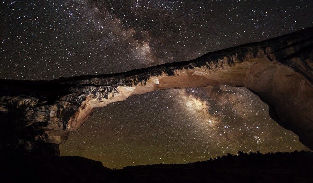
Natural Bridges National Monument was designated the world's first International Dark Sky Park in 2007 because there is virtually no light pollution and visitors can view an amazing night sky. National parks and monuments add so much more than just beautiful day-time landscapes.
Geovandalism
Geovandalism is the act of a person or persons deliberately damaging natural features of the Earth’s surface.

The Goblet of Venus was a gravity-defying rock pedestal near Natural Bridges National Monument and had been called “one of the best-known landmarks in the state” by Desert Magazine just a year before its fall. In June 1948, the Goblet was toppled, and despite assistance from the FBI, the culprits were never found. There are several stories on how this happened. The most prevalent is that a group of youths drove out one night and pulled the Goblet off of its pedestal using a chain hooked to a Jeep. No matter how it happened, the Goblet is gone, and many generations of visitors are now unable to marvel at its beauty. Very sad story indeed.
Next Time
I’m not sure what I will write about for my next post. During the summer, I tripped fell and completely tore my Achilles tendon. I’ll be heading into surgery today to repair it and begin the healing process. In the days afterward, there’s no telling what I will feel like writing about. Prayers and good thoughts are welcome! Make sure you keep your feet on the trail and don’t trip.
Please like this post and share with others!!


As a piece of history of Natural Bridges N. M. myself, I commend the author's article, which is quite accurate throughout. I worked at the Monument as a seasonal ranger in 1970-71, and again in 2018-2022. In between those times, I traveled to the area frequently, and led up to 16 backpack trips into the Dark Canyon Wilderness nearby Bears Ears. I'll add that NABR (Park Service parlance) was the first National Monument established in Utah, and didn't get a road to it until the late 1920s. The Moki Dugway is today much the same as it was in 1970, truly an experience for the casual traveler, but in 1970 it was actually better than the Hwy 95 alternative, the Comb Ridge Dugway. People would arrive at the Bridges sometimes trembling having taken that route. A modern crossing of Comb Ridge was completed about 1973.
As for Bears Ears, an 1850s U. S. government survey learned the Spanish derivation, "Orejos del Oso". That name remained on many maps well into the 20th century before becoming Anglicized to Bears Ears.
I love the phrase 'the bee's knees' but now I'm going to have to say bridges are 'the bear's ears!'
I did not know the difference between arches and bridges. Thanks!