


Tuzigoot National Monument
Preserving the land the pueblo is on has helped heal scars from mining and land over-use

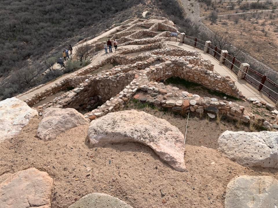
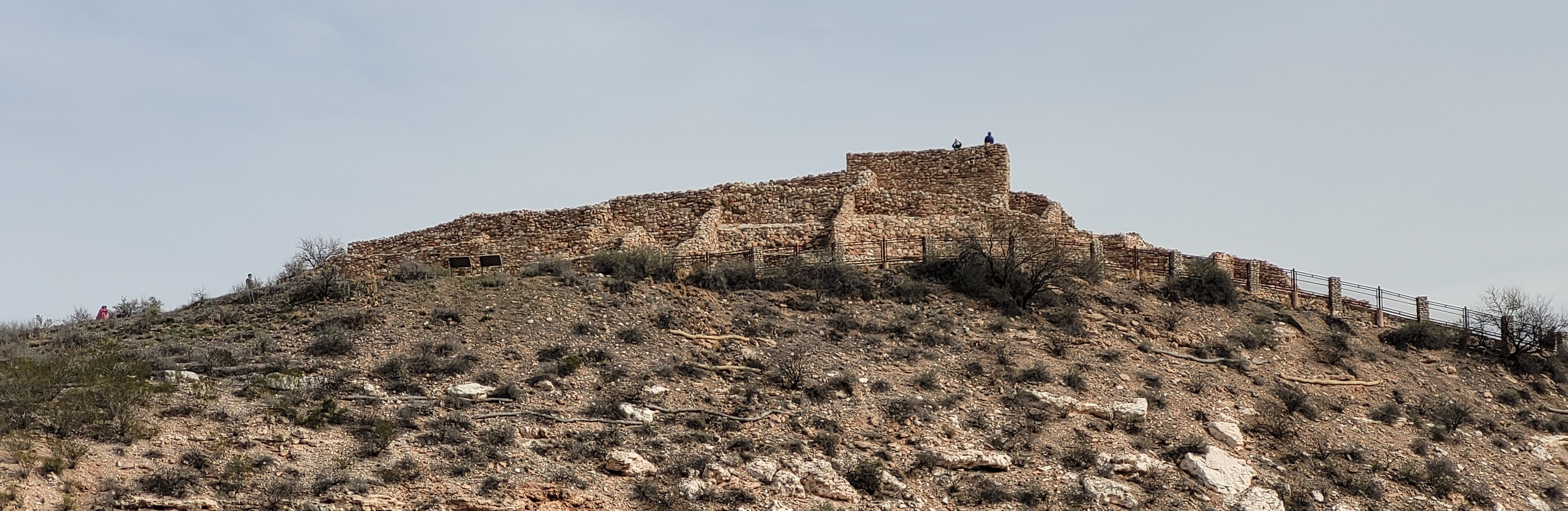
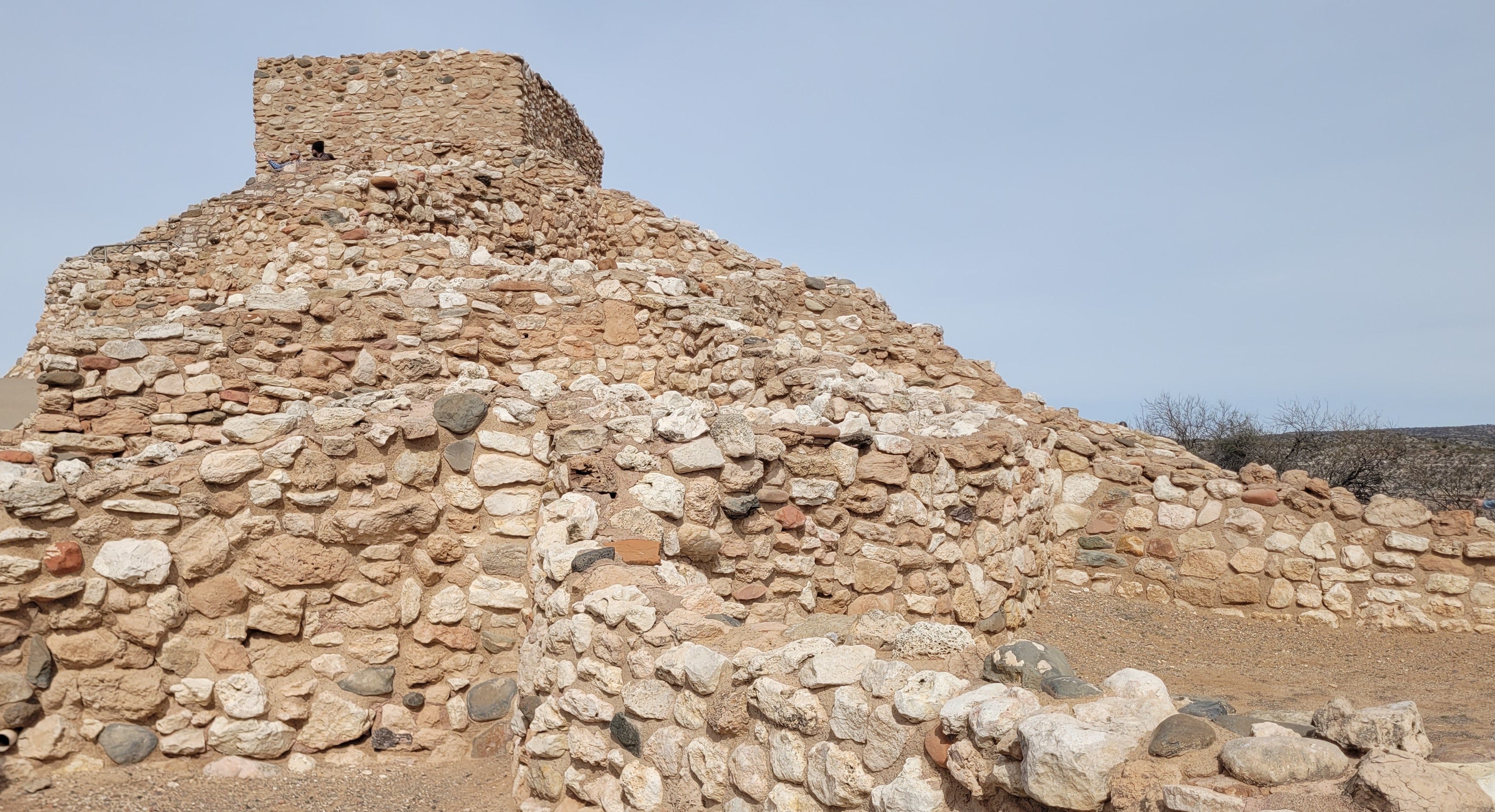
Approximately one thousand years ago, the Sinagua ancient people built a multi-storied pueblo on a hilltop in the Verde Valley near Clarkdale, Arizona. The top of the Tuzigoot pueblo has clear lines of sight in every direction and can easily be seen from many of the other hills - and pueblos - in the area. The name Tuzigoot is an Apache word that translates to “crooked water”.
Preserving this land as a national monument has helped the surrounding land be restored and “healed” from scars left by mining and agricultural over-use.

The Pueblo
The word pueblo is the Spanish word both for "town" or "village" and for "people". When the word is capitalized, it refers to the Puebloan indigenous tribes of the American Southwest. Otherwise, it refers to the permanent indigenous towns of these people.
The pueblo was built by the Southern Sinagua people between 1125 and 1400 CE (Common Era formerly AD) and is the largest and best preserved of the many Sinagua ruins in the Verde Valley. The ruins show that the pueblo incorporated very few doors; instead, the inhabitants used ladders accessed by trapdoor type openings in the roofs to enter each room.
Excavating the Pueblo
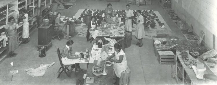
The land was once owned by United Verde/Phelps Dodge mining corporation who sold the site to Yavapai County for $1 so that excavations could be completed under federal relief projects of the Great Depression. The land was in turn transferred to the federal government.
Tuzigoot was excavated from 1933 to 1935 by researchers from the University of Arizona funded by federal programs under the New Deal during the Great Depression such as the Civil Works Administration and Works Project Administration.


Trading with Other Peoples
During the excavation of Tuzigoot pueblo, trade items and materials from hundreds of miles away were found. While the Southern Sinagua people had their own style of pottery, distinctive pottery from many different communities across the southwest was found here, as were seashells, exotic minerals and paints, obsidian from distant volcanoes, and feathers from scarlet macaws, which are found from southern Mexico into the Amazon basin of South America. People living here probably collected/processed and exported minerals, including azurite, malachite, and copper, as well as salt, cotton, and textiles.
National Monument Status Preserves the Pueblo
President Franklin Roosevelt proclaimed Tuzigoot National Monument on July 25, 1939. The Tuzigoot National Monument Archeological District was listed on the National Register of Historic Places on October 15, 1966.
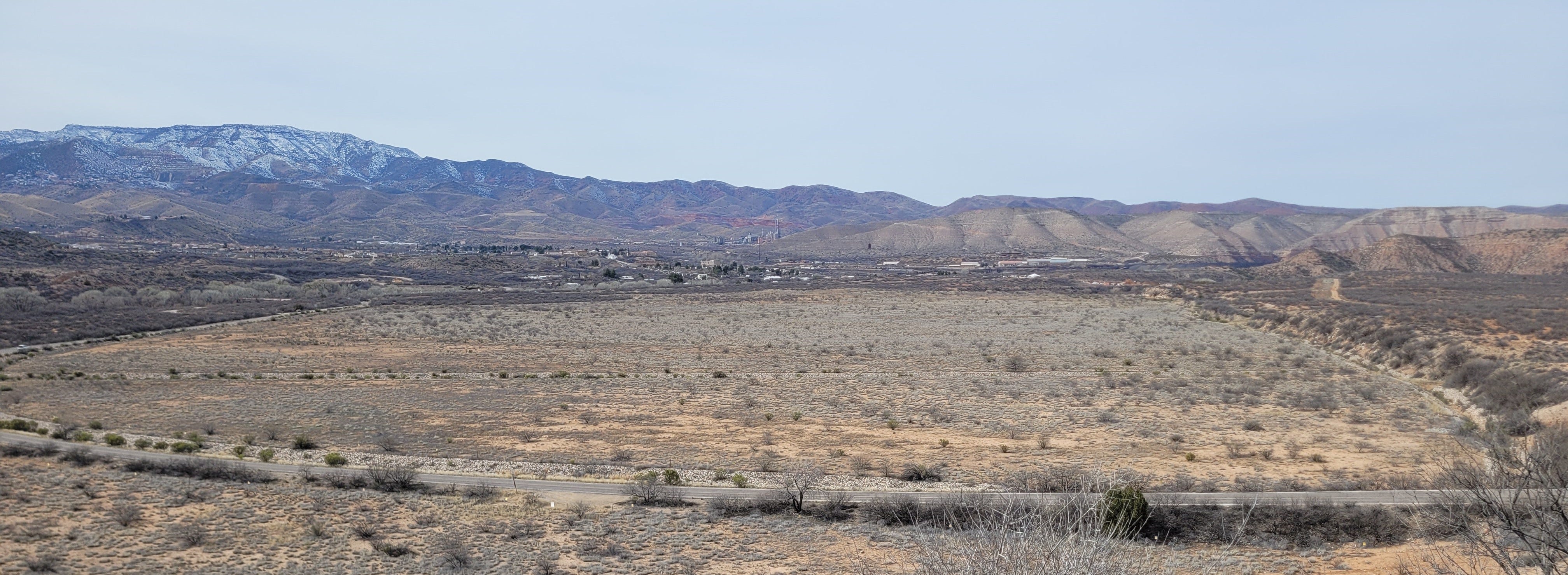
Land Disturbed by Mining Activities
I mentioned previously that the land containing Tuzigoot was owned by United Verde/Phelps Dodge mining corporation. Currently, the ruins are surrounded by the mine tailings of the former United Verde copper mine at Jerome. These mine tailings are the waste materials left over from the copper smelting process.

In 2006, Phelps Dodge placed an evapotranspiration cap over the tailings to minimize runoff and pollution of the Verde River and groundwater. This cap is a two-foot-thick layer of soil and rock. In addition, a seed mixture of native plants was spread over the cap. No irrigation was needed as the native plants are capable of surviving with local rainfall. The thickness of the cap should ensure that all rainfall is either used by the plant community or evaporates, therefore the seepage of minerals and heavy metals from the tailings into groundwater or the Verde River should be minimal.
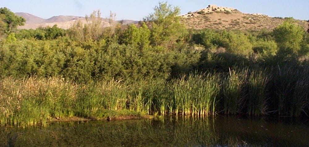
Tavasci Marsh
Separated from the Verde River over 10,000 years ago, Tavasci Marsh is a unique riparian area (relating to wetlands adjacent to rivers and streams) that is now one of the largest freshwater marshes in northern Arizona.
One hundred fifty years of irrigation, cultivation, mining and grazing activities greatly changed waterways, flora and fauna so that the area did not resemble what the land was like back in the mid 1800s before settlers arrived in the Verde Valley.
Back in the 1930s, the owners of the land drained areas of the marsh to irrigate their farm and gain pastureland. They performed control burns annually to remove cattails, dynamited mesquite bosques to clear additional land, trapped and shot beaver that previously dammed waterways. In addition, they planted non-native grasses for fodder and land stabilization.
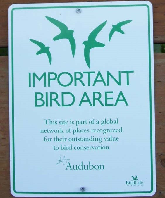
In the 1990s, the grazing lease was cancelled, and U.S. Fish and Wildlife installed water control features to restore the marsh to its historic size (80 acres). They added an observation deck and small trail system to create what is now considered an important birding site by the Audubon Society. In 1998 beaver have returned and built a large beaver dam which raised marsh waters.
In 2005, the NPS acquired Tavasci Marsh and it was added to Tuzigoot National Monument. This important riparian area can now be studied and preserved.
Many of us are aware of the fact that some human activities can affect the natural world around us. It’s great to know that the NPS and other entities are working on restoration, not just of historical sites but natural sites as well. We have a long way to go in this area but it’s good to see progress and learn how these processes are taking place.
How to Visit
Tuzigoot is 50 miles south of Flagstaff via US Alt. 89 (scenic road trough Oak Creek Canyon) and 100 miles north of Phoenix via Interstate 17 and AZ-260.
Tuzigoot has a visitor center and has short, hard-surfaced walking trails around the pueblo. For more information and for park alerts, please visit the NPS website.
Next Time
I wanted to take a break from the indigenous peoples of the Southwest and talk about (wo)man’s best friend. Bark Ranger programs have been instituted in many National Park Service units. It’s a great way for your furry family member to join in on the family vacation.

A large marsh area, beavers and their dams, as well as birds, all make for a good conservation effort. Excellent.
AZ 🧡